 Tweet
Tweet
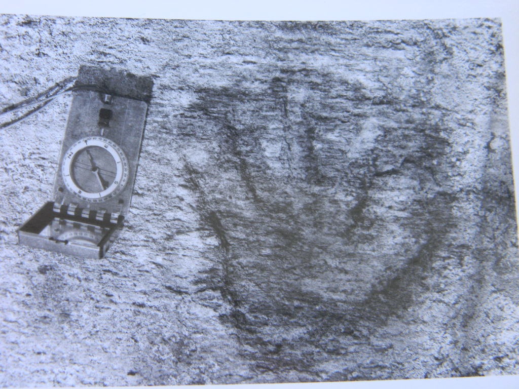
The Mark Rock petroglyph site is located on the Providence River in Kent Co., RI. It was first investigated and recorded by Edmund Delabarre of Brown University in the early 1900's. In 1928, he published "Dighton Rock" which was a study of the Dighton Rock petroglyph site as well as every other site he could locate in RI, and to a lesser degree, bordering states. In 1979 I revisited the site, uncovered some glyphs that had been buried under the sands since Delabarre's time, and recorded some glyphs for the first time that Delabarre had missed. In 2002, my friend, and former state archaeologist of NJ, Edward Lenik, published "Picture Rocks. American Indian Rock Art in the Northeast Woodlands", which included a section on Mark Rock, and included a few of my photos. I will post links to these works at the end of this thread entry.
The dot within a circle is one of the most common petroglyph motifs in the Americas. Perhaps the world? Tyson posted a photo of such a design on a panel in Colorado in the "Off the Wall" category. There are several examples at the Mark Rock site. First, is a human figure, which Delabarre interpreted as a native depiction of a colonial soldier with breast straps and buttons. It must be stated, though, that Delabarre believed natives only began creating petroglyphs after seeing Europeans write on paper, and these petroglyphs are of unknown age. At any rate, this is the best preserved human figure above the sands, although last I checked, it had become covered.
![Click image for larger version
Name: image_2013-01-29 [replaced].jpg
Views: 310
Size: 169.4 KB
ID: 218270](filedata/fetch?id=218270&d=1468852298)
![Click image for larger version
Name: image_2013-01-29-2 [replaced].jpg
Views: 251
Size: 256.1 KB
ID: 218271](filedata/fetch?id=218271&d=1468852309)
This next one is most interesting. You can see 3 circles in the NE, SE, and SW quadrant of the design. Now look in the NW quadrent. The circle is completely exfoliated, but the camera still sees it, as well as lines connecting it to the NE and SW circles, and a circle in the center. In the negative of this photo, the exfoliated circle and lines are dramatically visible. Delabarre noticed the same phenomenon. The invisible circle could not be seen, at all, by the naked eye! This entire panel, as seen in the 2nd photo below, was destroyed by storms years ago, except for the little sun symbol, which I believe can still be discerned.
![Click image for larger version
Name: image_2013-01-29-3 [replaced].jpg
Views: 247
Size: 269.5 KB
ID: 218272](filedata/fetch?id=218272&d=1468852318)
![Click image for larger version
Name: image_2013-01-29-4 [replaced].jpg
Views: 244
Size: 227.1 KB
ID: 218273](filedata/fetch?id=218273&d=1468852325)
From Delabbare's study, the 4 anthropomorphic figures he found. From left to right, buried, buried, destroyed by storms, buried, but not deeply:

Next, a dot within circle design that shows "modern improvement" in what looks like a shallow drilled hole at center, but the rest is pecked and both Lenik and myself think it's a native glyph. He told me he has seen similar designs elsewhere. Dots with circles again.

Storms have taken a severe toll on portions of this ledge that remained above ground after Delabarre's study. Many of the glyphs he recorded have not been seen by Lenik or myself, because much of the ledge went under the sand and mud years ago, perhaps as a result of the 38 or 54 hurricanes. The ledge is certainly still there and hopefully those glyphs survived. If so, they are safe under the sands.
Delabarre's study, available here:

And Delabarre's chapter on Mark Rock, including all his photos and illustrations:
http://archive.org/stream/dightonroc...e/236/mode/2up
Part of Lenik's chapter on Mark Rock, including my photos:
http://books.google.com/books?id=yIQ...island&f=false
The dot within a circle is one of the most common petroglyph motifs in the Americas. Perhaps the world? Tyson posted a photo of such a design on a panel in Colorado in the "Off the Wall" category. There are several examples at the Mark Rock site. First, is a human figure, which Delabarre interpreted as a native depiction of a colonial soldier with breast straps and buttons. It must be stated, though, that Delabarre believed natives only began creating petroglyphs after seeing Europeans write on paper, and these petroglyphs are of unknown age. At any rate, this is the best preserved human figure above the sands, although last I checked, it had become covered.
This next one is most interesting. You can see 3 circles in the NE, SE, and SW quadrant of the design. Now look in the NW quadrent. The circle is completely exfoliated, but the camera still sees it, as well as lines connecting it to the NE and SW circles, and a circle in the center. In the negative of this photo, the exfoliated circle and lines are dramatically visible. Delabarre noticed the same phenomenon. The invisible circle could not be seen, at all, by the naked eye! This entire panel, as seen in the 2nd photo below, was destroyed by storms years ago, except for the little sun symbol, which I believe can still be discerned.
From Delabbare's study, the 4 anthropomorphic figures he found. From left to right, buried, buried, destroyed by storms, buried, but not deeply:
Next, a dot within circle design that shows "modern improvement" in what looks like a shallow drilled hole at center, but the rest is pecked and both Lenik and myself think it's a native glyph. He told me he has seen similar designs elsewhere. Dots with circles again.
Storms have taken a severe toll on portions of this ledge that remained above ground after Delabarre's study. Many of the glyphs he recorded have not been seen by Lenik or myself, because much of the ledge went under the sand and mud years ago, perhaps as a result of the 38 or 54 hurricanes. The ledge is certainly still there and hopefully those glyphs survived. If so, they are safe under the sands.
Delabarre's study, available here:
And Delabarre's chapter on Mark Rock, including all his photos and illustrations:
http://archive.org/stream/dightonroc...e/236/mode/2up
Part of Lenik's chapter on Mark Rock, including my photos:
http://books.google.com/books?id=yIQ...island&f=false


Comment